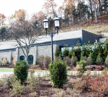
AEI has considerable geotechnical resources experienced in South Central Kentucky karst topography, characterized by underground drainage systems with caves and sinkholes. AEI’s Hidden River Cave client had a quick-turnaround need for a significant amount of cave data to support future design projects. In response, AEI provided terrestrial LiDAR scanning services, traversing deep into the cave to provide an accurate LiDAR point cloud model of the cave system. We used a RIEGL VZ-400 3D laser scanner in addition to a Trimble S6 Total Station and Trimble R10 GPS unit. The R10 was also used to stake out key points on the surface for potential drilling locations.
The survey provides an accurate and geo-located point cloud model so AEI’s structural staff can design a swinging bridge throughout the cave. The engineers and designers were provided the point cloud along with a Topo showing contours so they could access the data and make design recommendations off the scan data.
The project site was quite challenging–steep terrain, mud banks, massive and slippery rocks to climb over, and a river running through the cave. Surveyor safety is always a priority so the LiDAR scanner was used to collect the data safely and meet the client’s expectations and deadline.


